We use cookies to ensure our site functions properly and to store limited information about your usage. You may give or withdraw consent at any time. To find out more, read our privacy policy and cookie policy.
Manage Cookies
A cookie is information stored on your computer by a website you visit. Cookies often store your settings for a website, such as your preferred language or location. This allows the site to present you with information customized to fit your needs. As per the GDPR law, companies need to get your explicit approval to collect your data. Some of these cookies are ‘strictly necessary’ to provide the basic functions of the website and can not be turned off, while others if present, have the option of being turned off. Learn more about our Privacy and Cookie policies. These can be managed also from our cookie policy page.
Strictly necessary cookies(always on):
Necessary for enabling core functionality. The website cannot function properly without these cookies. This cannot be turned off. e.g. Sign in, Language
Analytics cookies:
Analytical cookies help us to analyse user behaviour, mainly to see if the users are able to find and act on things that they are looking for. They allow us to recognise and count the number of visitors and to see how visitors move around our website when they are using it. Tools used: Google Analytics
Share Ballyallia Amenity Enhancement Plan on FacebookShare Ballyallia Amenity Enhancement Plan on TwitterShare Ballyallia Amenity Enhancement Plan on LinkedinEmail Ballyallia Amenity Enhancement Plan link
Consultation has concluded
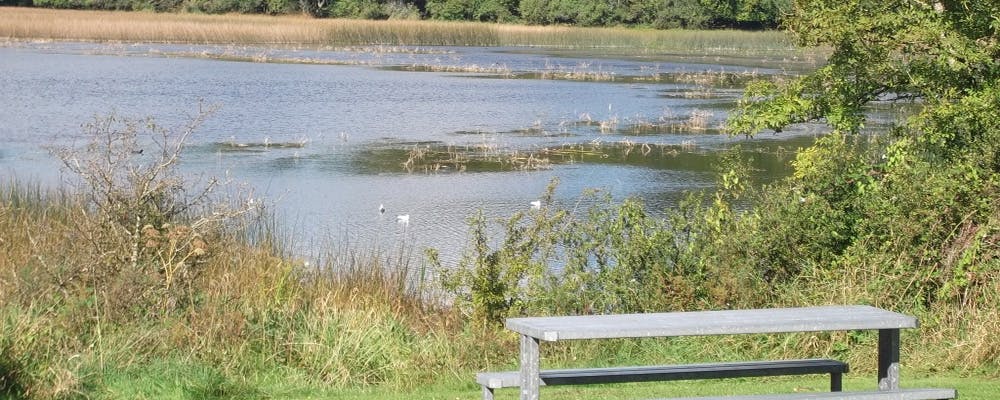
Ballyallia Lake also known as Ballyallia Lough is located on the river Fergus north of Ennis, Co. Clare, covering an area of 308 hectares, it has been recognised as a wetland of international importance under the Ramsar Convention. It is designated as a Special Area of Conservation and a Special Protection Area for bird species in addition to being a proposed Natural Heritage Area.
Clare County Council are developing detailed designs to sensitively enhance this lakeside amenity, whilst also considering the wider environment of the Lake. These designs build on the 'Amenity Enhancement Plan for Ballyallia Lake' which was commissioned by Barefield Tidy Towns, supported by Clare County Council and Clare Local Development Company and have been further informed through focused consultation with key stakeholders including environmental consultants. The original masterplan was developed in line with the following policy plans and documents
Clare County Development Plan 2017-2023
Clare County Biodiversity Action Plan 2017-2023
County Clare Heritage Plan 2017-2021
The current proposed design looks to ensure the sustainable development of the area while strengthening its role to the wider Ennis town area as an amenity space. Following public consultations, it is the intention to submit a planning application to An Bord Pleanala in Q4 2022. Funding has yet to be secured for the implementation phase of this project.
Consideration has been given to submissions received at the first consultation on September 8th 2022 and online up to September 19th, thus the design of the proposed enhancement scheme has evolved. A second public consultation to review the design evolution will be held in Barefield Community Centre on October 12th from 5-8pm. Members of the public can also view the updated drawings (on the right) and make an online submission anytime from October 12th - 28th @ 4pm.
The road infrastructure in the area does not form part of this enhancement plan, however a map with proposed changes has been uploaded for your reference (to the right).
Share Your comments / feedback on FacebookShare Your comments / feedback on TwitterShare Your comments / feedback on LinkedinEmail Your comments / feedback link